|
Home |
Search the Database |
Display Index |
Contact Us |
Database Login
|
The national database of state and local wildfire hazard mitigation programs
serves as a clearinghouse of information about nonfederal policies and
programs that seek to reduce the risk of loss of life and property through
the reduction of hazardous fuels on private lands. If
you would like to submit a program to the national wildfire programs database,
please complete the following form (MS
Word).
Return to your search results or Perform a new search
|
Title: |
Colorado WUI Assessment Mapping Project
|
|
Type: |
Education
Designation of high risk areas
|
|
Jurisdiction: |
State
|
|
State: |
Colorado
|
|
Program Description: |
The Colorado WUI Hazard Assessment Mapping Project
Background
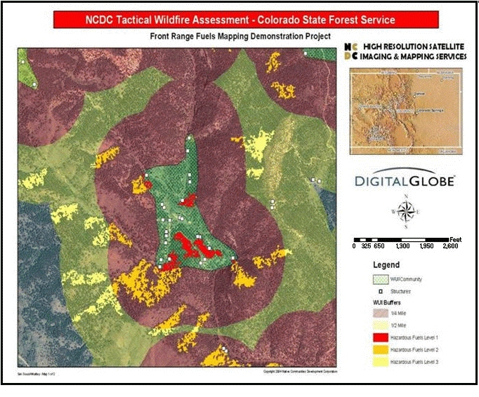
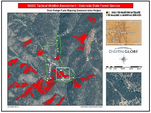
Colorado�s first mapping project to identify high fire hazard risk areas was the �Front Range Redzone Project�. This project incorporated slope, aspect and fuels, and looked only at the area of the state with the highest housing density � the urban and suburban Front Range of the Rockies. The resulting map showed areas of high wildfire risk in red and became known as the Red Zone Map. The map was very useful in early work to target areas of high wildfire hazard with mitigation and education projects.
The Colorado Wildland Urban Interface Hazard Assessment builds on the work of the Red Zone Map, and provides new and updated data to enhance accuracy and scale. The assessment includes all the counties in Colorado. The final output of the mapping project is a Risk, Hazard and Value (RHV) Map (available on the CSFS website), which graphically displays areas of risk for catastrophic wildland fire. The map is at a 30 meter scale. The Assessment is meant to be used as a tool to compare fire hazard statewide in Colorado, and within counties. The data is not at a scale to determine risk at the subdivision or parcel level.
The project is a joint effort of the Colorado State Forest Service (CSFS), US Forest Service, Bureau of Land Management, National Park Service, and other interested parties.
Approach
The WUI Hazard Assessment uses three main map layers to determine fire danger: Risk, Hazard, and Value. These are comprised of the factors below:
1. Risk � Probability of Ignition
a. Lightning Strike Density - areas are ranked from very low to high density for lightning strike occurrences.
b. Road Buffer � 100 meter buffer of roads and railroads in Colorado.
2. Hazard � Vegetative and topological features affecting intensity and rate of spread
a. Slope � slopes of 6-20% are ranked Moderate; 21-40% are ranked Steep; and slopes greater than 40% are ranked extreme.
b. Aspect � Southeast, and Southwest facing slopes are ranked 3, and South facing slopes are ranked 4.
c. Fuels � Interpreted from CDOW GAP Vegetation information, rankings are based on Fuel Hazard and Disturbance Regime. Fuel Hazard represents a qualitative ranking from 1-5 based on flammability during an average burn day. Disturbance Regime is also a qualitative ranking based on the average length of the fire return interval.
3. Values � Natural or man-made components of the ecosystem on which a value can be placed.
a. Housing density � Life and property. Data was created using a combination of parcel data, well head location data, and Census information. Projections were made for housing densities in 2010 and 2020 to create future risk projections.
4. Nonflammable areas mask � a mask was created to aid in the analysis for areas that will not carry fire such as rock and water areas. Urban areas which did not have enough vegetation to carry fire were covered with the mask.
The three component variables � Hazard, Risk and Value were added together to create the final HRV grid which shows areas at high risk of catastrophic wildland fire in the urban interface. Values ranged from 2-15 and were color-coded for best display. Two final outputs were created: the Risk+Hazard+Value (RHV) Map, and a new Red Zone Map, which displays high hazard areas in red.
Contact Information
For more information, contact Skip Edel, of Colorado State Forest Service, at [email protected], or by phone at 303-202-4314.
|
|
Images: |
|
1. | 
|
|
|
|
2. | 
|
|
|
|
|


