|
Home |
Search the Database |
Display Index |
Contact Us |
Database Login
|
The national database of state and local wildfire hazard mitigation programs
serves as a clearinghouse of information about nonfederal policies and
programs that seek to reduce the risk of loss of life and property through
the reduction of hazardous fuels on private lands. If
you would like to submit a program to the national wildfire programs database,
please complete the following form (MS
Word).
Return to your search results or Perform a new search
|
Title: |
Genesee Subdivision, CO - Wildfire Risk Assessment Using BEHAVE and WHINFOE
|
|
Type: |
Fuelbreaks
Firewise community recognition programs
Designation of high risk areas
Community Planning
|
|
Jurisdiction: |
Subdivision
|
|
State: |
Colorado
|
|
Program Description: |
Genesee Subdivision, Golden, CO � Wildfire Risk and Mitigation Study
The Genesee Subdivision is located 18 miles west of Denver just south of I-70. It connects to I-70 by a single primary ingress/egress road. Genesee has worked with the Colorado State Forest Service for 20 years to plan and carry out thinning activities on its open space lands. In 2002, the Genesee Foundation contracted with Anchor Point Fire Management Company to develop a scientifically based wildfire hazard risk assessment and mitigation plan. The entire text of the study is available on the Genesee Foundation website.
Wildfire Hazard Risk Study
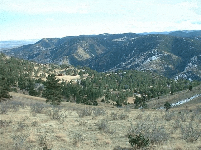
The study area includes the community of Genesee and most of the Genesee Fire District and consists of 2,195 acres. The land is in the montane zone of the eastern slope of the Northern Colorado Front Range, with elevations ranging from 5,470 � 8,499 feet. The forest is pine dominated with some grassy open meadows. Forested areas consist mainly of ponderosa pine and Douglas fir. Within the study area there are 868 structures, predominately residential.
The goals of the study are to:
- Raise awareness of fire hazard risk among residents, and educate them about how to reduce risk and avoid unintentional fire starts;
- Prioritize areas of high hazard in designated Fire Management Zones with specific actions to reduce fuels in these areas;
- Promote the reintroduction of fire into a fire adapted landscape;
- Create short-term and long-term plans for fuel and fire management.
Structure of the Study
The study used the BEHAVE Fire Behavior Prediction and Fuel Modeling System to determine anticipated spread rates and flame lengths for the three dominant ground covers within the subdivision. The results were mapped to show fire hazard risk due to anticipated surface fire intensity. The study also employed the WHINFOE (Claire M. Hay, PhD - Metro State College of Denver) Wildfire Hazard Information Extraction model to determine hazard due to topography, aspect, vegetation classification and housing density. The study uses satellite imagery in the 2-meter and 30-meter resolution. The analysis led to the creation of a final map of Areas of Concern which showed areas where slope, aspect, topography, fuel types, fire intensity and housing density all came together to put community values at risk.
Fire Management Zones
Major areas of concern were designated as Fire Management Zones (FMZ). Four kinds of Fire Management Zones were recommended. These are:
- Riparian FMZ;
- Escape Routes FMZ;
- Home Mitigation FMZ;
- Prescribed Fire FMZ.
Within each FMZ specific vegetation and mitigation management activities are recommended.
Riparian FMZ
A healthy stream corridor can function as a fuel and fire break. Stream corridors should be integrated into a fuel break design network.
Escape Route FMZ
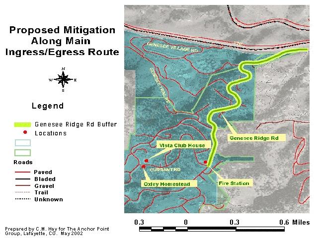
The study recommends a 200 foot buffer on the major ingress/egress road from the intersection with I-70 to the Genesee Fire Station. The width should be increased proportionally in areas of steep slope. Escape route signs should be posted on major routes. And vegetation clearance guidelines published by the Colorado State Forest Service should be adhered to.
Home Mitigation FMZ
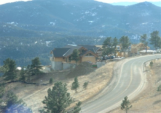
An area of 102 homes was selected as a pilot area for a Home Mitigation FMZ. This area is at high risk due to fuel conditions and steep slopes. It is recommended that individual homes be assessed for fire hazard risk, that education efforts focus on this area, and that defensible space techniques be emphasized to homeowners. Genesee participates in the Firewise Communities USA program. And it was recommended that a pre-attack/operational plan be developed for the Home Mitigation FMZ.
Prescribed Fire FMZ
The study selected a seven acre parcel where prescribed fire could be utilized to reintroduce the tool to the landscape and residents of the community. Genesee has been doing 10- acre fuels treatments with slash pile burns for the past 20 years. This would be the first prescribed burn in the Genesee community, and will take much public education and support to be considered a viable tool. The selected site is within a residential area.
Contact Information
For more information, contact Ryan Babcock, Genesee Foundation Open Space Operations Manager, at (303) 526-9463 or by email at [email protected]. Or contact Chris White at Anchor Point at 303-665-FIRE (3473), by email [email protected].
|
|
Images: |
|
|


