|
Home |
Search the Database |
Display Index |
Contact Us |
Database Login
|
The national database of state and local wildfire hazard mitigation programs
serves as a clearinghouse of information about nonfederal policies and
programs that seek to reduce the risk of loss of life and property through
the reduction of hazardous fuels on private lands. If
you would like to submit a program to the national wildfire programs database,
please complete the following form (MS
Word).
Return to your search results or Perform a new search
|
Title: |
Helena, MT-- Project Impact Homeowner Assistance Program
|
|
Type: |
Homeowner assistance
Fuelbreaks
Designation of high risk areas
|
|
Jurisdiction: |
County
|
|
State: |
Montana
|
|
Program Description: |
Project Impact, Helena Metropolitan area, Montana, offers prescriptive clearing of defensible space around homes, with a cost share approach. Administered by the Tri-County Fire Working Group, homeowners in Wildland Urban Interface areas, identified by fire risk maps in Jefferson, Lewis & Clark, and Broadwater counties are eligible to participate. The program is funded by National Fire Plan grants trhough USFS, BLM, Montana DNRC, and FEMA hazard mitigation grants.
Program Goals
The goals of the program are to create defensible space with disaster- resistant landscaping around and adjacent to homes, improve the health of the forest area, reduce the risk of loss from wildfires, and maintain wildlife habitat and aesthetic values. Homeowners must agree to maintain the defensible space for a minimum of 10 years, or until a change of ownership, if less than the 10 year period.
Methodology
A representative of Tri-County Fire Working Group meets with the homeowners and walks the site. A complete assessment of fire hazards is done including fuel modification needs, visible address, roadway access, building characteristics, and other hazards. The homeowner is given a list of corrections he should make in areas beyond the scope of the vegetation modification program, and a prescription for fuel reduction tailored to his situation. Plans create 100'-150' of defensible space around each home, working out in concentric rings from the foundation using the 30'-100'-150' model. Highly flammable fuels such as Ponderosa Pines are removed or spaced 15'-20' feet apart. Lodgepole pines are isolated in islands. Trees are pruned up to 10'-12'.
Homeowners can qualify for up to $1,000 of project money on a 75/25 match basis. Project Impact pays 75% of the cost, and homeowners contribute 25% either in money or volunteer work. On projects over a $5,000. cost, there is a 50/50 match. Fuel reduction work is completed by an independent contractor.
Ongoing Projects
TCFWG completed plans for 220 homes by April 2003, and has done some larger projects that protect several homes on one site. They have had great progress on roadside fuel mitigation projects which work on a subdivision-wide scale. And they are treating open space lands that are within the City of Helena ownership.
Subdivision Regulations
On February 1, 2005 Lewis and Clark County adopted the Wildland Subdivision Standards, a new section of county code that provides minimum requirements for subdivision design, fire protection availability, water supply, access routes, roof materials and fire protection plans. All proposed subdivisions within the mapped high hazard zone must comply with the new regulations.
Program Recognition
The Greater Helena Area's wildfire mitigation program is featured in the FEMA publication "At Home in the Woods Lessons Learned in the Wildland/Urban Interface. The article, called "Counties Give Wildfire a Run for Its Money", describes the area's history of wildfires, the development of the cost-share assistance program, and shows the Fuel Hazard Rating map for the Helena region. In 2005, Keep Montana Green recognized three area contractors for their work in fuel hazard reduction planning and project work.
Contact Information
For more information, contact Pat McKelvey, or by phone at 406-447-8225.
|
|
Images: |
|
1. | 
|
|
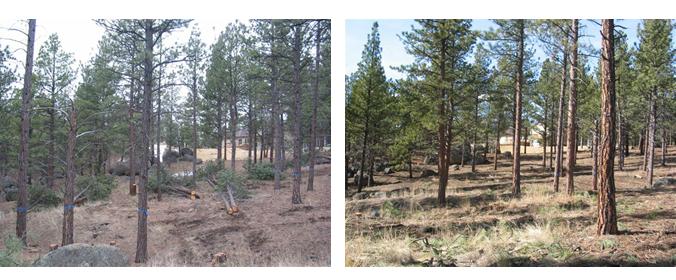
Project, during mitigation and after mitigation.
|
|
2. | 
|
|
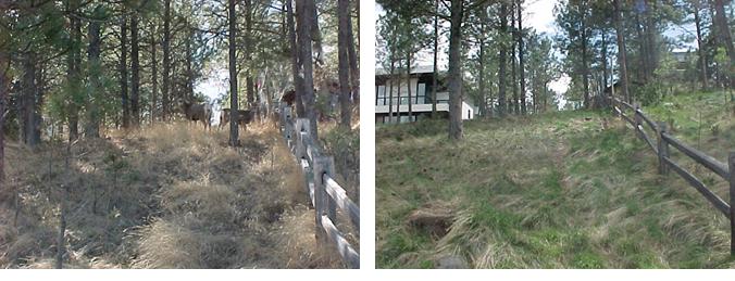
Cooke Street photos before and after. This project is within 1/2 mile of the State Capital Building.
|
|
|


